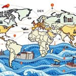
As the world confronts the mounting pressures of climate change, a profound synergy is emerging between cutting-edge spatial technologies and sustainable finance mechanisms. This alliance is driving transformative decisions that address physical climate risks, guide resilient investments, and uphold global environmental commitments.
By fusing precise location-based insights with financial strategies, stakeholders gain unparalleled visibility into hazards, exposures, and impact metrics—enabling a new era of accountability and effectiveness across public and private sectors.
At its core, geospatial data comprises digital information linked to specific coordinates on Earth, generated through satellites, remote sensing, GIS, drones, and IoT sensors. Climate finance encompasses the flows of capital—public, private, and philanthropic—dedicated to reducing greenhouse gas emissions, enhancing adaptation, and building resilience in line with frameworks like the Paris Agreement.
This convergence, often called spatial finance, embeds location intelligence into decision-making processes, delivering unprecedented transparency, granularity, and accuracy in risk assessment and investment planning.
The explosive growth of geospatial data is fueled by small satellites, advanced sensors, and AI-driven analytics. Daily, high-resolution global coverage has become a reality, generating petabytes of imagery and sensor outputs that can be harnessed for climate action.
Meanwhile, global climate finance needs are staggering. Experts estimate that approximately $4.5 trillion annually will be required by 2030 to meet mitigation and adaptation goals under the Paris Agreement. Without targeted, data-driven investments, many regions risk falling behind in resilience and sustainability.
Geospatial intelligence directly ties environmental hazards—such as floods, heatwaves, and wildfires—to financial assets. This dynamic insight empowers insurers, banks, and investors to calibrate risk models in real time, adapt credit portfolios, and price insurance products with unprecedented precision.
A diverse constellation of organizations is advancing this field at scale. Financial institutions—from global banks to niche asset managers—are embedding geospatial analyses into their risk and due diligence frameworks.
Geospatial climate finance rests on several core technologies that convert raw spatial inputs into actionable insights:
These tools, when integrated seamlessly, create a powerful feedback loop: sensors collect data, AI refines insights, and financiers deploy capital where impact and resilience can be maximized.
Agriculture leverages geospatial analytics to monitor crop health, soil carbon content, and irrigation efficiency—bolstering food security and climate-smart practices in vulnerable regions.
Infrastructure planners use spatial risk overlays to assess transportation networks and energy grids exposed to storm surges or extreme heat, enabling targeted retrofits and resilient design.
Conservation projects map corporate operations against protected areas to track biodiversity impacts and guide sustainable land-use decisions. Urban municipalities adopt geo-enabled dashboards for flood management, green infrastructure planning, and socioeconomic resilience investments.
The integration of spatial data with finance brings four pivotal advantages:
First, rapidly growing partnership reshaping finance improves transparency, closing information gaps between investors, regulators, and communities.
Second, asset-level data allows for direct observation of environmental conditions reduces reliance on self-reported metrics, enhancing accountability.
Third, by providing real-time or near-real-time data, geospatial platforms outpace traditional reporting cycles, granting agile, timely decision-making.
Finally, this approach fortifies resilience by identifying vulnerabilities before they escalate, safeguarding supply chains, property values, and ecosystem services.
Looking ahead, global institutions are investing heavily in accessible, cloud-based geospatial risk platforms. The IMF, World Bank, and G20 are spearheading efforts to standardize data protocols, ensuring that all countries can leverage hazard, exposure, and vulnerability layers for climate resilience.
Innovations such as national digital twins—virtual replicas of physical systems—are gaining traction in countries like France and the Netherlands, providing dynamic scenario planning and stress-testing capabilities.
Meanwhile, open asset-level datasets and targeted capacity-building programs, driven by research bodies like the Spatial Finance Initiative, are closing the data and skills gaps that remain.
By 2030, climate-smart investments by pinpointing high-opportunity regions and objective verification of sustainability claims will become standard practice, reinforcing trust and accelerating the transition to a low-carbon, resilient global economy.
The partnership between geospatial data and climate finance is no longer a niche innovation—it is rapidly becoming the backbone of sustainable investment and policy-making.
By harnessing high-resolution spatial intelligence, stakeholders can illuminate hidden risks, measure impact with rigor, and channel capital toward solutions that safeguard communities and ecosystems.
In this evolving landscape, collaboration among financiers, technologists, and policymakers will determine how effectively we address the defining challenge of our time. The path to resilience and net-zero goals lies in embracing this powerful alliance, ensuring that every investment is guided by the clarity of geography and the urgency of climate action.
References