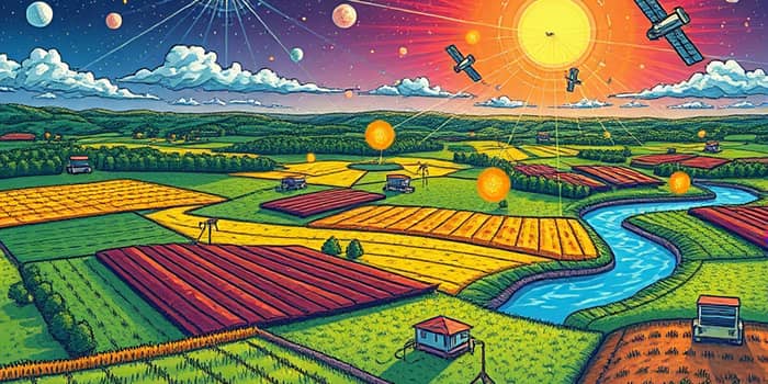
In an era of accelerating climate challenges, a new technological frontier is emerging. Edge computing combined with remote sensing is driving a hyperlocal climate data revolution, transforming how we monitor and adapt to floods, droughts, water quality shifts, biodiversity loss, and emissions at the neighborhood, field, and watershed scales.
By processing data where it originates—on sensors in remote terrains or satellites orbiting the earth—this approach slashes dependencies on high-latency cloud links and massive bandwidth consumption. Stakeholders from water managers to financiers are harnessing these insights to quantify risks, demonstrate returns, and attract targeted climate finance.
Edge computing refers to the practice of running compute workloads on or near devices where data is generated. Remote sensing leverages IoT sensors and high-resolution satellites to observe Earth’s systems. Together, they deliver efficient local processing at the source, supporting dynamic decision-making.
Key technical benefits include:
Real-world deployments illustrate these gains. Credit Valley Conservation in Ontario operates 40 IoT sensors across an 860 km² watershed on a Scale Computing edge platform. In volcanic island imaging, Satellite Mobile Edge Computing achieved over 11% energy savings and processed 12 times more images than traditional downlinks.
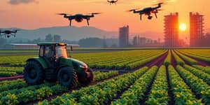
From smallholder farms to urban flood zones, edge-enabled sensing is powering a host of climate solutions:
University of Wyoming’s edge sensory platforms at UW-AMK Ranch, backed by a $40K grant, exemplify on-site processing in harsh environments. NASA’s JPL New Observation Systems embed neuromorphic chips on commercial satellites to autonomously beam down only critical flood-response analytics.
Hyperlocal data not only informs climate action but also drives capital flows. When investors can quantify risks and rewards locally, they gain confidence to underwrite resilient infrastructure, blended finance vehicles, and innovative instruments like SAFEs.
Consider these finance milestones:
By integrating hyperlocal climate metrics into insurance risk models, lenders can reduce premiums for climate-smart agriculture or resilient urban retrofits. Blended finance structures—loans, equity, and grants—are growing, with adaptation-first projects rising to 35-40% of applications.
The climate finance landscape is evolving rapidly. Key predictions for the coming years include:
These shifts highlight a move toward nature-based solutions for resilient infrastructure and demonstrate how precise, localized data underpins emerging market opportunities.
Despite impressive momentum, hurdles remain. Many emerging markets face capital gaps, limited digital infrastructure, and regulatory uncertainties. To unlock scalable impact, stakeholders must:
Edge computing platforms themselves must become more accessible and cost-efficient, leveraging open-source frameworks and flexible financing to reach underfunded communities.
As we look toward 2035 and beyond, hyperlocal climate data will be ubiquitous. Neighborhood-level projections will inform urban planners, insurers, farmers, and citizens in real time.
By 2035, meeting the NCQG target of $300B per year for developing countries depends on robust local data streams processed at the edge. This ecosystem will drive resilient infrastructure, nature-based solutions, and circular economies—backed by transparent metrics and accountable financing.
Edge computing and remote sensing are more than technologies; they are pillars of a new climate finance paradigm. By bridging the digital divide in even the most remote landscapes, they empower stakeholders to adapt, mitigate, and thrive in a warming world.
References